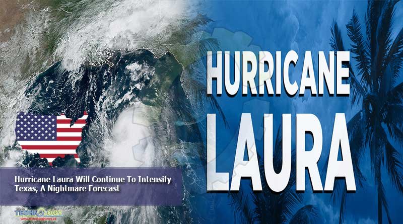
It seems increasingly likely that Hurricane Laura will continue to intensify on Tuesday and Wednesday before making landfall along the upper Texas coast, or possibly southwestern Louisiana, early on Thursday.

Of all the many named storms in 2020—and we are on the “L” storm already with the early September peak of the Atlantic hurricane season still looming—this one has the potential to wreak the most widespread devastation yet. This is because Laura will likely become a major hurricane before landfall, reaching Category 3 status, and could potentially strike the populous Houston metro area.
That happens to be where I live, in a home about 15 miles from the coast. And as a meteorologist, all I can think is here we go again. Just three years ago to this very date, Hurricane Harvey brought record flooding to the Houston community and its surrounding areas. It became the worst flood storm in US history.
In retrospect, Harvey was a relatively easy storm to forecast. Because its primary threat was flooding, it didn’t really matter where the storm’s center was going to go. The big-picture details were clear. Harvey was a slow-moving system. It was going to plow into the central Texas coast and then stall. This would allow it to drop a large amount of rain over a large area.
So we knew a lot of rain was coming, although we did underestimate its amplitude. During the course of five days, Harvey dropped an average of 34.72 inches across an area of 10,000 sq. miles. That is about the size of Massachusetts. How does this compare with previous US records? Well, prior to Harvey, the record came from a storm back in the 1890s, when an average of 21.39 inches fell over an equivalent area. Harvey smashed that by 62 percent.
What we know about Laura is that it decidedly will not be another Hurricane Harvey. The storm has a forward motion of about 16mph, and if anything, it should accelerate north and then northeast once it reaches the western edge of a high-pressure ridge. So it will bring some rain to the coast, maybe six to 10 inches for a relatively small area.
The bigger threat from Laura, by far, is high winds and storm surge. Both of these are highly dependent upon the storm’s track. In the case of winds, they are strongest near a storm’s relatively small core, and usually to its northeast. Surge, which is caused by a storm essentially pushing water along with it as it moves toward the coast, is worst to the right of a hurricane, as that is the side with winds blowing from sea to shore.
Which brings us back to Houston. Right now, the metro area lies on the extreme western edge of the National Hurricane Center’s forecast cone. The storm is predicted to make landfall about 90 miles to the east of Houston. This is far enough away from the storm’s center to spare a metro area with a population of 7 million people from the worst. In fact, much of the city would not even see tropical storm-force winds.
But if the storm were to come in 90 miles to the west, along Galveston Island, it would be an entirely different story. And this is entirely within the realm of possibility, given the average forecast track error of about 75 miles at this time and the fact that some hurricane models still indicate this scenario.
What would be the implications of this? Catastrophic winds would move into Houston, potentially the likes of which have not been seen since 1961 and Hurricane Carla. We’re talking about weeks without power in the fourth-largest city in the country, widespread structural damage, and many deaths amid an ongoing pandemic.
So the real issue for meteorologists and public officials is this: the odds of a truly catastrophic hit on Houston are probably about 25 percent versus the city taking a more glancing blow. Do you sound the alarm and say, “Everybody run for the hills!”? Or do you play the odds, avoiding a panicked evacuation that can sometimes be more deadly than a hurricane itself? This is nerve-wracking for a forecaster who sees a major metro area’s fate balancing on a knife’s edge. On top of all this, it’s 2020, so anything goes.
For now, the messaging I’ve been going with on my personal website, Space City Weather, is to lay out these possibilities and tell readers that they need to be prepared for the eventuality of a major land-falling hurricane and to act as such. As always, we should prepare for the worst and hope for the best.
And boy, are we really hoping.
The article is originally published at ars technica.