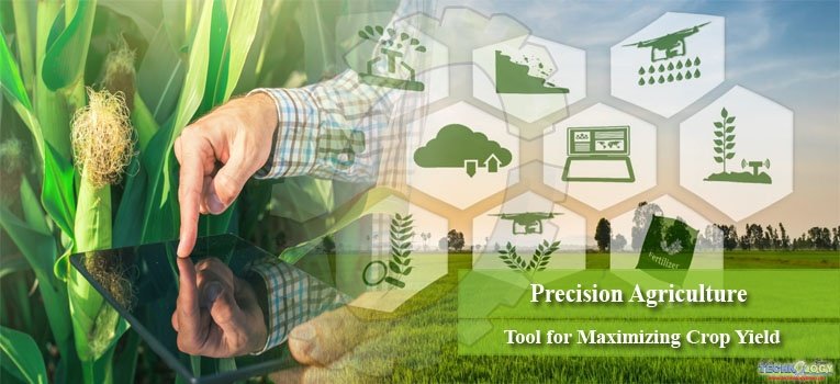
Precision agriculture is an approach to farm management that uses information technology to ensure that the crops and soil receive exactly what they need for optimum health and productivity. Precision farming is an integrated agricultural management system incorporating several technologies.
Precision farming is defined as information and technology-based farming management system to identify, analyze, and manage variability within fields for optimum profitability, sustainability and protection of land resources. Precision farming is geared toward increased productivity in the face of variability found within the fields.
It is not aimed at obtaining same yield everywhere rather same input on site specific that can guarantee long term benefit/cost ratio. The concept of “doing the right thing in the right place at the right time” has a strong intuitive appeal which gives farmers the ability to use all operations and crop inputs more effectively.
Why Precision agriculture?
-> Contribute to better use of resources (space wise and time wise) Nutrients, water, pesticides
-> Environmental benefits (Exact use at exact place very less transfer to non-target area)
-> More Profitability (Through very accurate use with short time and less labor we get maximum with minimum)
Some other plus point of this new technologies it should also serve smallholder farmers in wheat and maize based systems i.e. penetration of cell phones in countries where we work is >80% ‘From the description of site-specific activities it is obvious.
Although Precision agriculture, as seen in Europe and North America, is largely irrelevant in developing countries. The aim of precision agriculture is to apply the right input in the right place at the right time and in the right amount for sustainability in production agriculture
Component of Precision Farming
The technological tools often include: Global positioning system, Remote Sensing Geographic information system, Yield monitor, Variable rate technology. The variable rate applicator has; a. Control computer, b. Locator and c. Actuator. The application map is loaded into a computer mounted on a variable-rate applicator. The computer uses the application map and a GPS receiver to direct a product-delivery controller that changes the amount and/or kind of product according to the application map.
Future satellites will have better spatial and spectral resolutions. Launching more satellites will also improve temporal resolution; hence the delivery time of remote sensing data to the customer will improve. Even third world will begin to fully practice precision agriculture Future of precision Agriculture.
1) Global Positioning System (GPS)
GPS is the only system today able to show exact position on the Earth surface anytime, under any weather, anywhere. The three parts of GPS are: •Satellites •Receivers •Software
i) Satellites: There are quite several satellites out there in space. They are used for a wide range of purposes: satellite TV, cellular phones, military purposes. Satellites can also be used by GPS receivers. The GPS Operational Constellation consists of 24 hours. Characteristics of GPS • Free • Precise • Reliable • Anytime & anywhere • All-weather • Unlimited user capacity.
2) Geographical Information System
Geographic Information System (GIS) is a computer system for capturing, storing, querying, analyzing, and displaying geospatial data. Geospatial technology is listed by the U.S. Department of Labor (2012) as one of the three emerging industries, along with nanotechnology and biotechnology. Basic Functions of GIS. Data Acquisition and prepossessing. Database Management and Retrieval. Spatial Measurement and Analysis.
Graphic output and Visualization GIS activities can be grouped into spatial data input, attribute data management, data display, data exploration, data analysis, and GIS modeling. GIS Operations A vector-based overlay operation combines spatial data and attribute from different layers to create an output. Layer Complex data Overlay Soil Moisture Layer Crops Layer Roads layer Final map
Geospatial data are data that describe both the locations and characteristics of spatial features such as roads, land parcels, and vegetation stands on the Earth’s surface.
- Geospatial data are better maintained in a standard format. • Revision and updating are easier. • Geospatial data and information are easier to search, analysis and represent. • More value-added product. • Geospatial data can be shared and exchanged freely.
3) Remote sensing can reveal in-season variability that affects crop yield and can be timely enough to make management decisions that improve profitability for such crop.
Elements of Remote Sensing
1. Energy Source or Illumination
2. Radiation and the Atmosphere
3. Interaction with the Object
4. Recording of Energy by the Sensor
5. Transmission, Reception and Processing
6. Interpretation and Analysis
7. Application Remote Sensing
Types of sensors 1. Optical sensors 2. Microwave sensors Passive sensors (Optical)
Remote sensing keep tract of mapping and monitoring large farms These include; current extent of crops, disease infestation, crop stage of growth, soil degradation, irrigated area, yield prediction etc. Retrieval of information through spectral remittance. Decision Support; using the information retrieved critical decision can be taken to solve immediate problems.
Benefits of Precision Agriculture
The significance of geospatial technology in agriculture lies to the fact that agriculture is spatial in nature. GIS can store information in the form of layers such as soil nutrient level, yield map, soil moisture content, Evapotranspiration etc. GPS can be used in farm machinery automation and unmanned farm vehicles time and money are saved. Better decision can be made.
Benefits of GIS
- Productivity of the staff improved and more efficient. • It is the collection of data from a distance without necessary meeting the surface. Data sensors can simply be hand held devices, airborne or space borne. Plant stress related to moisture, nutrients, compaction, crop diseases and other plant health concerns are often easily detected in overhead images. Precision agriculture can address both economic and environmental issues that surround production agriculture today.
Challenges in precision agriculture
How skilled are the farmers to take advantage of gamut of technologies that comes their way? At the fore front of these challenges are the reputation of farmers that geospatial systems are difficult to learn. That is hard to process data to make meaning out of it. Academicians in third world countries on geospatial systems are adamant to address their immediate problem of environment.
There is phobia of using anything to do with computer, satellite etc., this is not only to farmers but even among academics. Therefore, there is need to train and retrain all stakeholders in geospatial systems to be able to make use of the abundant and free satellite data online for sustainable agricultural development and other environmental issues.
Future perspective
Challenge of 9 billion world population in 2050 and provide food security. Problem of resistance in pests, resurgence and emergence of new pest with the passage of time.it is helpful to cope with environmental adverse condition. It will also help to enhance and make better the agriculture system of third world countries.
Conclusion
It’s an innovative method which guides farmer for better agriculture and farming. It’s also provided better information for management decisions. It provides the present and future guide lines for farmer. It is also contributing to maximizing the profit and minimizing the health and environmental hazards. It also plays major role to ensure food security to feed the more than 7 billion population.
Talha Javed, Habel Parwaiz, Ahmed Mukhtar, Shahnwaz and Tahawar Ali Syed
University of Agriculture, Faisalabad, Pakistan
Corresponding author: talhajaved54321@gmail.com